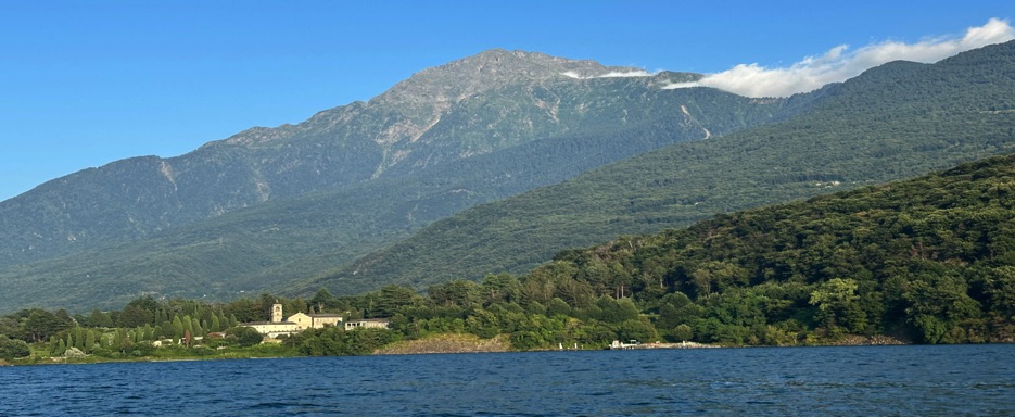
Monte Legnone Bergamo Alps in Lombardy I Italy Added (05/2025)

Monte Legnone, with its 2,609 m a.s.l., is the highest peak in the province of Lecco and in the western side of the Orobie Alps in Lombardy, northern Italy. It is located between the valleys of Valsassina and Valtellina near Lake Como and Colico.
It is clearly easy to recognize for the gigantic pyramid shape that dominates the Lario in the shape of an inverted letter "Y" with its waters of glacial origin that overlook extraordinary uncontaminated beauty, lakeside villages, such as the famous resort of Bellaggio and historic villas and with its panoramic coast against the hills of the magnificent views of the Alps.
Info re: What are the Orobie Alps
The route description
In this beautiful hiking trai there are basically three ridges: The west, the east and the south. The west ridge is the most well known. We started from Roccoli dei Lorla refuge( 1460 slm) which is located in the west and located between Monte Legnone and Legnoncino.
The path begins near the Roccoli dei Lorla Refuge once the car is parked and I bought a Day ticket there is a sign in in the proximity of a small pond that indicates the departure for the Legnone path. The path crosses Alpe Argogno and flat from which they will begin to open panoramic windows and enjoy beautiful basic views of the surrounding mountains of Valtellina and Lake Como.
Arrived near the Silvestri bivouac (Cà de Legn), the route becomes a decidedly more demanding, arduous and steep pianino pianino when you get to the crest with the help of some metal cables (already present on the walls) you reach the top where the cross, the ibexs are located and you can admire breathtaking views of the high lake, on the Valtellinesi Orobie and the Valchiavenna mountains.
Details
Starting point: Rifugio Roccoli Lorla
Maximum altidude: 2609 m
Lenght: 12 Km
Duration Over 3h30 for the ascent, 3h for the descent
Technical difficulty: The hike has a difficulty level of EE (expert hikers) and consists of a long climb, for the most part decided, steep, with exposed sections and on rocks equipped with fixed ropes and steps
Trail type: Loop
Video with photos
