

Stawamus Chief Hike – Iconic Adventure in Squamish, British Columbia, Canada

The Stawamus Chief, officially Stawamus Chief Mountain, is an impressive granite monolith located next to the town of Squamish in British Columbia, Canada.
Its iconic shape, rising over 700 meters, is visible from the road and is world-famous for both rock climbing and the steep hiking trail that climbs steadily toward one of its three peaks. From the top, a true natural balcony opens onto spectacular views of Howe Sound and the surrounding mountains.
The Stawamus Chief hike, locally known as “The Chief”, is one of the region’s most iconic trails. Squamish is known as the “Outdoor Recreation Capital of Canada”, a true paradise for lovers of climbing, mountain biking, kayaking, and scenic hikes. Rising majestically from the town, the Chief challenges hikers and climbers with its three peaks, offering breathtaking views of the surrounding wilderness.
Trail and Route on Stawamus Chief
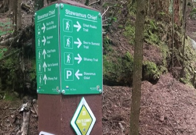
Starting Point: Squamish Forest
From the parking lot, the trail winds through red cedars and Douglas firs, with ferns and moss forming a green carpet over roots and rocks. Small songbirds and squirrels accompany your first steps, while the massive granite monolith towers above.
Steep Sections, Steps, and Inclines
After 15–20 minutes, the trail becomes more challenging. Here you will encounter rock steps and wooden stairs, essential for tackling the initial steep sections. Through the trees, the first views of Howe Sound and the town of Squamish begin to appear.
Granite Slabs and Water Puddles
Beyond the initial stretch, the trail crosses wide granite slabs. Some cracks collect small puddles, reflecting the sky and mountains. In these areas, the granite can be slippery, so caution is needed. You may spot Steller’s jays, marmots, salamanders, and other small animals among salal and huckleberry shrubs. The environment is immersive, rich in mosses, lichens, and natural sounds.
Exposed Sections and Aluminum Ladders
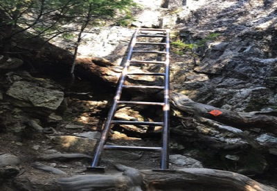
Approaching the peaks, some very steep sections are equipped with silver aluminum ladders, installed to ensure safety on vertical parts. Climbing these ladders gives a small thrill, but the view and sense of accomplishment make every effort worthwhile.
The Three Peaks of Stawamus Chief
First Peak
After about 1.5–2 hours, you reach the First Peak, with panoramic views of Howe Sound, the nearby islands, and surrounding mountains. It’s the perfect spot for a break and memorable photos.
Second Peak
The Second Peak is quicker to reach but still includes rock steps, scrambling sections, and metal ladders. Water puddles on the granite slabs create beautiful reflections, while the panorama extends across the fjord.
Third Peak
The Third Peak, the highest, requires focus and strength. The trail alternates steep sections, steps, and scrambling, with aluminum ladders aiding the final stretch. From the summit, enjoy a 360° view of mountains, forest, fjord, and sky.
Wildlife Along the Trail
During the hike on Stawamus Chief, it’s common to encounter chipmunks and squirrels, often very confident, especially near the peaks. On scenic viewpoints, you can often see whiskey jacks (Canada jays), known for approaching hikers in search of food.
The area is also a prime habitat for black bears, typically spotted in the lower forested sections of the trail. On the towering granite walls above Howe Sound, peregrine falcons also nest, adding to the wild and dramatic environment.
Conclusion: A Hike to Share
I have hiked Stawamus Chief multiple times, always in good company, and every time it delivers new emotions. It’s worth repeating and sharing with locals in Squamish or international friends, because the views are spectacular and the experience truly unique. On a clear day, with no clouds, the sunlight on the granite, the waters of Howe Sound, and the surrounding mountains makes this hike unforgettable.
📌 Trail Information
• Starting Point 📍: Stawamus Chief Parking Lot
• Distance 🥾: 7.5 km (full loop)
• Time Required ⏱️: 5–6 hours
• Elevation Gain ⛰: 690 m
• Difficulty 💪: Medium–Challenging
• Trail Map 📍: View the Map – Coming Soon
Coming Soon