
Monte Legnoncino Hiking In Lecco, Lombardy Italy
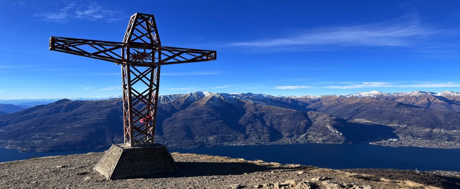
Monte Legnoncino, located in Valvarrone, at the western end of the Orobie Alps, reaches 1,714 meters above sea level. It is considered the smaller peak of the Legnone group, with its more famous twin, Monte Legnone, standing at 2,610 meters. Situated in the province of Lecco, Lombardy, Monte Legnoncino offers a beautiful hiking experience with panoramic views of Lake Como, Pian di Spagna, Valchiavenna, and the surrounding Alps.
This moderate hike primarily follows mule tracks and paths that are not as demanding as the ascent to Monte Legnone. The route provides incredible views and an immersive nature experience, making it perfect for hikers looking for a relatively easy yet scenic adventure.
Route Description
I embarked on this hike with my brother Claudio, and my dog Izia, a Lagotto Romagnolo. We drove from Colico to the town of Dervio, and then continued toward the small village of Tremenico. Here, we followed the signs leading to Roccoli Lorla (1,463 meters). At Roccoli Lorla, we found a small lake and a parking area, which served as the starting point of our hike.
Izia, being a Lagotto Romagnolo, is known for her enthusiasm for outdoor adventures and her love for water, making her the perfect companion for mountain hikes like this one.
From Roccoli Lorla, we followed the mulattiera (mule track), a historic military road, winding its way through a variety of vegetation, including fir and larch trees. The ascent began gently, with a few hairpin bends, and soon we were greeted by breathtaking panoramic views.
Continuing along the path, we passed the remains of World War I trenches and lookout posts, which provided a fascinating glimpse into the region's history.
At the summit of Monte Legnoncino, we found the chiesetta di San Sfiri, a small church that stands as a peaceful tribute to the mountain’s spiritual and historical significance. From here, we were treated to a spectacular panorama of Lake Como, the surrounding valleys, and the surrounding mountain peaks.
The view also included the picturesque riverside villages along the lake. The summit cross, standing at 1,714 meters, completes the scene, surrounded by stunning alpine landscapes. After soaking in the views, we retraced our steps back down the same route.
Route Details
Maximum Altitude: 1,714 m (5,623 ft)
Distance: 9 km (5.6 miles)
Duration: Approximately 3-4 hours
Technical Difficulty: Medium-easy
Trail Type: Loop
Recommended Period: June - October