

Cycle Tour | Circumnavigation of the Iberian Peninsula: from the Mediterranean to the Atlantic and Back – Stage #7
🇪🇸 Stage 7: Along the Mediterranean Coast of Spain to La Jonquera, Catalonia
Spain & Southern France – Coastal Return and Southern Winds
Turning toward the southern coast of Spain, I began to follow the long, sweeping lines of the sea. Leaving the Costa de la Luz, facing the Atlantic, I entered the Costa del Sol, the luminous Mediterranean heart of Andalusia, cycling through iconic cities such as Málaga and Marbella, where sunshine and the sea set the rhythm of daily life.
Continuing eastward, the journey followed the Costa de Almería to the city of Almería, before reaching the Costa Cálida, home to the historic city of Cartagena. From there, the route continued along the Costa de Valencia, passing through Valencia, a vibrant and contemporary Mediterranean city.
Further north, I pedaled along the Costa Dorada, reaching Tarragona, before entering Catalonia. Passing through Barcelona, dynamic and open to the sea, the route continued along the rugged beauty of the Costa Brava, finally arriving in La Jonquera, at the foot of the Pyrenees and on the border with France. Here, I left Spain behind, closing the final great coastal chapter of my Iberian circumnavigation.
🇪🇸 Stage 7.1 I Day 43: Bed & Breakfast, Manilva – San Luís de Sabinillas → BQ Andalucía Beach Hotel, Torre del Mar (Málaga), Spain
The morning welcomed me with warm, golden light as I left my cozy Bed & Breakfast in Manilva. With my panniers loaded and the bike ready, I reached the sea by following the seaside promenade of San Luís de Sabinillas.
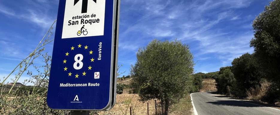
The Mediterranean was calm, its surface glowing under the first rays of sunlight, and EuroVelo 8 guided me along the Costa del Sol, riding between palm trees and the sea.
Today’s ride took me through some of the most famous seaside resorts on the coast: Estepona, Marbella, Mijas, Fuengirola, and Benalmádena, all lined with long stretches of golden sand. Southwest of Málaga, I crossed the Parque Natural del Guadalhorce and passed San Andrés Beach (Huelin) before reaching Vélez-Málaga. Near Benajarafe, the ancient Torre Moya still stood watch from its promontory, a silent witness to centuries of history.
In the late afternoon, I arrived in Torre del Mar, part of the municipality of Vélez-Málaga, where I checked in at the BQ Andalucía Beach Hotel. The town stretches along a lively seaside promenade, with well-kept and fully equipped beaches such as Playa del Poniente and Playa del Faro.
Later, I explored the town center, visiting the Church of San Andrés, the Sugar Museum, and Plaza de la Axarquía, dominated by its elegant circular white building. Of the Castillo del Marqués, once a fortress, only the memory remains today no castle to visit, no reconstructed walls.
Dinner was at a local restaurant with outdoor tables, surrounded by the soft evening buzz of the town. Back in my spacious hotel room, overlooking the pool and restaurant area, I reviewed the next day’s stage: a simple route, once again following the coastline.
After sending a few messages to family and friends, I fell asleep easily, lulled by the promise of another day of cycling along the sea.
📌 Route information and footage with GoPro
• Region / Area 🌍 : Costa del Sol, Province of Málaga, Andalusia (Spain)
• Main Locations 🏘 : Manilva → San Luís de Sabinillas → Estepona → Marbella → Fuengirola → Benalmádena → Málaga → Vélez-Málaga → Torre del Mar
• Distance 🚴 : ~ 140 km
• Total Time ⏱️ : [.....], including scenic and photo stops
• Terrain 🛣️ : Mostly coastal and flat, with urban sections, bike paths, promenades, and short rolling hills; asphalt and well-maintained cycleways
• Direction 🧭 : West → East, along the Mediterranean coast
• Route Map 📍: View the map
🇪🇸 Stage 7.2 – Day 44 | BQ Andalucía Beach Hotel, Torre del Mar (Málaga) → Camping Castillo de Baños, Polopos (Costa de Granada), Spain
Morning sunlight filtered into my hotel room, waking me early. I went downstairs for breakfast and enjoyed the generous buffet, surrounded by the lively hum of tour groups speaking different languages. The selection was so abundant that I knew I wouldn’t need to eat again until the evening.
As tempting as the hotel pool was, the road was calling. I loaded my panniers onto the bike and set off along the palm-lined seafront of Torre del Mar, soon leaving the city behind.
The coastal road gently wound through light climbs and descents, passing Torrox-Costa, until near Nerja the elegant arches of the Eagle Aqueduct (Puente del Águila) appeared. Still in use today, it stood proudly against the landscape a remarkable example of 19th-century engineering.
The route followed the dramatic cliffs of Punta de la Mona, opening up breathtaking views over Almuñécar, nestled between the sea, valleys, and mountains. After riding through a headland tunnel, Salobreña came into view, its white houses crowned by a hilltop castle. Beyond Motril, another tunnel revealed wide-open coastal scenery, with villages such as Gualchos, Lújar, and Rubite overlooking broad beaches lapped by clear waters.
In the late afternoon, I arrived in the quiet seaside village of Castillo de Baños. My destination was Camping Castillo de Baños, a small beachfront campsite with pitches, bungalows, and a swimming pool.
I pitched my tent under the curious gaze of a few local cats, then took a walk through the village: the well-preserved fortress, the beach, and a small supermarket where I bought dinner. The shop was run by a friendly Sino-Spanish owner who proudly told me about the village’s peaceful life, despite its very small population.
As evening fell, I sat outside my tent, enjoying a simple dinner just steps from the sea. The sound of the waves breaking on the shore gently lulled me to sleep, ready for the road awaiting me the next day.
📌 Route information and footage with GoPro
• Region / Area 🌍 : Andalusia, Southern Spain
• Main Locations 🏘 :Torre del Mar → Torrox-Costa → Nerja → Almuñécar → Salobreña → Motril → Castillo de Baños
• Distance 🚴 : ~ 91.7 km
• Total Time ⏱️ : [.....], including scenic and photo stops
• Terrain 🛣️ : Mostly paved coastal roads, with rolling hills and some flat sections
• Direction 🧭 : West → East along the Costa Tropical
• Route Map 📍: View the map
i
🇪🇸 Stage 7.3 – Day 45 | Camping Castillo de Baños, Polopos (Costa de Granada) → Hostel Delfín Verde, Almería, Spain
The dawn opened with a sky painted in soft colors. I took a walk around the campsite, enjoying the calm of the sea before packing up my tent and preparing the bike. The cats returned for breakfast, and I shared some of my food with them before setting off.
The EuroVelo 8 narrowed again to the single available road, winding through coastal stretches and semi-desert landscapes. Near El Pozuelo, beneath an imposing highway bridge, I met another long-distance cyclist heading in the opposite direction. We stopped for a quick exchange of greetings and stories before continuing on our separate ways.
The road led me to Adra, where I followed a coastal bike path, shaded by palm trees and bordered by empty beaches and a small harbor. Further inland, the landscape changed drastically: from El Ejido to La Gangosa, I rode through the famous "Mar de Plástico," an endless sea of white greenhouses where fruits and vegetables grow under plastic sheets.
The view was vast, almost surreal, but unsettling, with plastic scattered along the roadside, sometimes threatening the sea. Leaving this agricultural landscape behind, the coast returned, rugged and spectacular, with coves and cliffs near Torrenueva Costa, Calahonda, and Castell de Ferro.
By evening, I reached Almería, the provincial capital and gateway to the Cabo de Gata Natural Park. I stayed at Hostel Delfín Verde, a simple yet welcoming hostel by the seafront. My room had a breathtaking sea view, and my bike was welcome inside. At the entrance, photos of The Beatles on the walls reminded me that the band had stayed here years ago.
Dinner was a simple meal purchased nearby, eaten in my room before a stroll along the seafront and the fine sandy beaches with crystal-clear waters. Back in my room, I checked Google Maps to plan the next stage and ended the day as always: gazing at the sea and letting the sound of the waves lull me to sleep.
📌 Route information and footage with GoPro
• Region / Area 🌍 : Andalusia, Costa de Granada
• Main Locations 🏘 : Polopos → Adra → El Ejido → La Gangosa, Torrenueva Costa → Calahonda → Castell de Ferro →Almería
• Distance 🚴 : ~ 92.9 km
• Total Time ⏱️ : [.....], including scenic and photo stops
• Terrain 🛣️ : Mainly coastal road with semi-desert stretches
• Direction 🧭 : West → East along the Costa de Granada
• Route Map 📍: View the map
🇪🇸 Stage 7.4 I Day 46: Delfín Verde Hostel, Almería → Camping Bellavista, Águilas (Costa Cálida), Spain
The day began with sunlight filtering through the window of my room at Delfín Verde Hostel. After a quick breakfast with what I had bought the night before, I loaded my bike and set off along the seafront, the sparkling Mediterranean on my left.
Beaches adorned with palm trees and sand sculptures created by a local artist caught my attention before reaching Costacabana. Curiosity then led me onto a gravel path winding east through arid, deserted hills dotted with abandoned buildings.
On a steep climb, I had to push the bike, and from the crest I glimpsed the highway in the distance. Here I met a local cyclist; we exchanged a few words and said goodbye he returned to Almería, I continued into the unknown.
The path led to a quieter secondary road through Níjar, across vast greenhouse fields stretching as far as the eye could see, until reaching Fernán Pérez. Suddenly, the landscape opened onto one of Andalusia’s treasures: the Cabo de Gata–Níjar Natural Park, a wild and rugged protected area with volcanic cliffs, jagged promontories, and hidden coves accessible only on foot.
Every climb and descent revealed new views of the desert slopes meeting the Mediterranean, making every pedal stroke an adventure.
I stopped for lunch in the whitewashed village of Agua Amarga, nestled among the hills and near the sea. The serene square, quiet streets, and timeless atmosphere offered the perfect pause.
The route continued inland over semi-desert terrain before gradually returning to the coast at Carboneras, a lively town on the edge of the park. From here, the road opened like a balcony to the sea, with scenic terraces offering spectacular views.
In Macena, I admired the restored Castillo de San Ramón with its twin towers, and further along, in Villaricos, the 18th-century Castillo de Villaricos stood as a silent guardian of the coast.
By late afternoon, I reached Camping & Bungalows Bellavista, south of Águilas on the Costa Cálida. After setting up my tent, I went to Playa Matalentisco, a Blue Flag beach with a dog area, where Civil War bunkers quietly watched over the sea.
Back at the campsite, I bought dinner at the shop, sent a few messages to friends, and planned the next day’s stage, letting the sound of the waves and the tranquility of the Costa Cálida lull me to sleep.
📌 Route information and footage with GoPro
• Region / Area 🌍 : Andalusia, Spain
• Main Locations 🏘 : Almería → Níjar, Fernán Pérez → Agua Amarga → Carboneras → Macena → Villaricos → Águilas
• Distance 🚴 : ~ 130 km
• Total Time ⏱️ : [.....], including scenic and photo stops
• Terrain 🛣️ : Mainly secondary roads and coastal paths, with gravel stretches and gentle climbs
• Direction 🧭 : East along the Costa Cálida
• Route Map 📍: View the map
🇪🇸 Stage 7.5 I Day 47: Camping Bellavista, Águilas (Costa Cálida) → Camping Lo Monte, Torre de la Horadada, Alicante (Costa Blanca), Spain
I woke to a cloudy sky, broke down the tent, and loaded my bike before setting off along the coast. The route took me through the picturesque town of Águilas, with its seafront, golden beaches, and the imposing castle overlooking the bay between Punta Negra and Punta de la Águilica.
Soon, EuroVelo 8 led me along the hilly stretches of Cabo Cope and Puntas de Calnegre Natural Park, a protected coastal area where breathtaking Mediterranean views unfolded at every curve. The climbs and descents were challenging but rewarding, with peaceful rural landscapes and glimpses of the sea through the valleys.
I stopped briefly in Mazarrón, admiring the expansive Playa del Alamillo and its promenade. There, I met Barbara, a cheerful German cyclist traveling solo. We exchanged stories and well-wishes before continuing.
The road wound along the coast from Los Alcázares, passing the sandy beaches of Mar Menor, small villages, and stretches of farmland inland. The contrast between the tranquil lagoon and the open sea was striking, a reminder of the variety of landscapes in southeastern Spain.
By late afternoon, I reached Camping Lo Monte, a spacious campsite with caravans and motorhomes. Despite the high price for my small tent pitch, I was grateful for the peaceful green space nearby.
I set up the tent, bought dinner at the campsite market, and followed my usual evening routine, preparing for the next day’s ride along the Costa Blanca.
📌 Route information and footage with GoPro
• Region / Area 🌍 : Eastern Andalusia and Costa Blanca, Murcia and Alicante
• Main Locations 🏘 : Águilas → Mazarrón → Los Alcázares →Torre de la Horadada
• Distance 🚴 : ~ 112 km
• Total Time ⏱️ : [.....], including scenic and photo stops
• Terrain 🛣️ : Coastal roads, hilly sections, flat stretches, and gravel paths
• Direction 🧭 : East along the Costa Cálida and Costa Blanca
• Route Map 📍: View the map
🇪🇸 Stage 7.6 I Day 48: Camping Lo Monte, Torre de la Horadada → Camping Santa Clara, Altea (Costa Blanca, Alicante), Spain
I woke up early, broke down the tent, and loaded my bike. The day began along the N-332, a gently winding road just inland from the coast.
I pedaled past the towns of Dehesa de Campoamor and Torrevieja, skirting the edge of the Lagunas de la Mata-Torrevieja Natural Park, where two large salt lagoons reflected the morning light. To my right, the Mediterranean shimmered, and the contrast between sea and salt flats created a breathtaking scene.
The road continued through Guardamar del Segura, surrounded by lemon groves, and crossed the Segura River via an iron bridge. Passing La Marina and Santo Polo, I followed the edge of Salinas de Santa Pola Natural Park, with its fragrant, bird-filled marshes.
Arriving at the port of Alicante, I paused on a bench to admire the calm waters, moored boats, and lively seafront. Heading north, the road climbed through El Campello, passing Villajoyosa and Benidorm, offering spectacular views of the mountains and the sea.
By late afternoon, I reached Camping Santa Clara, just two kilometers from Altea. The campsite was quiet, with many empty pitches in the low season. After setting up my tent, I walked to a nearby supermarket to buy dinner, which I then enjoyed near my tent.
The staff kindly allowed me to use a small empty bungalow to sit comfortably, a gesture that made the day even more pleasant.
As always, I checked the next day’s route on Google Maps and Komoot, then fell asleep to the peaceful sounds of the campsite, ready for another day along the Costa Blanca.
📌 Route information and footage with GoPro
• Region / Area 🌍 : Alicante, Valencian Community, Spain
• Main Locations 🏘 : Torre de la Horadada → Dehesa de Campoamor → Torrevieja → Guardamar del Segura → Alicante → El Campello → Villajoyosa → Benidorm → Altea
• Distance 🚴 : ~116 km
• Total Time ⏱️ : [.....], including scenic and photo stops
• Terrain 🛣️ : Paved roads, seafront paths, gentle coastal climbs and descents
• Direction 🧭 : Southeast → North along the Costa Blanca
• Route Map 📍: View the map
🇪🇸 Stage 7.7 I Day 49: Santa Clara Campsite, Altea (Costa Blanca, Alicante) → Hostal Andrés, El Saler (Albufera Nature Reserve), Valencia, Spain
I woke up under a cloudy sky with some patches of blue. After breaking down the tent and loading my bike, I had a simple breakfast with the supplies I had bought the night before.
Riding out of the campsite, I was greeted by two friendly couples in motorhomes, who wished me a safe journey—a small gesture that brightened the start of the day.
Leaving Altea, I pedaled through the town center and along the wide seafront lined with palm trees, open to the sparkling Mediterranean.
Shortly after, I joined the scenic coastal N-332 road, gently climbing the El Morro de Toix promontory between Altea and Calpe. From the 200-meter cliff, the view stretched along the coast to the Peñón de Ifach, looming over Calpe Bay like a smaller version of the Rock of Gibraltar.
The climb continued through rugged rock formations like Mar Morta and Roques Negres, with reddish rocks and large cavities, creating a surreal and dramatic landscape. The road then descended toward Benissa, passing through artisanal towns like Gata de Gorgos, with its handmade craft shops, and Ondara, nestled among orange groves and mountains.
I followed the towns of Oliva and Gandia, meeting a few cyclists along the way, before reaching Tavernes de la Valldigna, Bega, and finally Cullera, with the Cullera Castle perched on the hill above the town.
The final part of the route led north to the small village of El Saler, south of Valencia, at the edge of the Albufera Natural Park, with its white sandy beaches and natural dunes. I checked in at Hostal Andrés, stored my bike in the garage, and settled into a spacious room with a small balcony and chairs.
For dinner, I bought something at a nearby shop and ate peacefully on the balcony. Later, I took a short evening walk to the Port de El Saler (Puerto Albufera), just ten minutes away.
The sunset painted the sky in shades of red, reflected on the calm waters where fishing boats rested. I glimpsed the nearby beaches as night slowly fell.
Back at the hostal, I completed my usual evening routine, sending messages and checking the route for the next day, before letting the silence and quiet of El Saler lull me to sleep, ready for the journey ahead.
📌 Route information and footage with GoPro
• Region / Area 🌍 : Alicante and Valencia, Spain
• Main Locations 🏘 : Altea → Calpe → Benissa → Gata de Gorgos → Ondara → Oliva → Gandia → Tavernes de la Valldigna → Bega → Cullera → El Saler
• Distance 🚴 : ~124 km
• Total Time ⏱️ : [.....], including scenic and photo stops
• Terrain 🛣️ : Paved roads, coastal promontory climbs and descents, flat stretches along beaches and towns
• Direction 🧭 : South → North along the Costa Blanca toward Valencia
• Route Map 📍: View the map
🇪🇸 Stage 7.8 I Day 50: Hostal Andrés, El Saler, Valencia → Camping Torrenostra (Torreblanca), Castelló, Costa del Azahar, Spain
I woke up very early, as the days in October were shorter, and I wanted to make the most of the daylight. Breakfast was quick in my room, then I packed up the tent, strapped the panniers onto the bike, and left El Saler behind. Riding along the bike path between L’Albufera and the sea, the first rays of sun reflected on the calm Mediterranean waters, creating a peaceful start to the day.
I pedaled towards Valencia, exploring the Turia Gardens, the old riverbed now transformed into a large urban park with smooth bike paths, and admiring the futuristic City of Arts and Sciences. Leaving the city, the EuroVelo 8 guided me toward Sagunto, passing through agricultural fields, orange groves, and quiet villages. Paved roads, gentle climbs, and small bridges made this stretch relaxing and scenic.
From Puçol to Sagunto, I followed the Greenway Ojos Negros, a cycling and walking path along a former railway. Lemon and orange groves framed the route, and the Sagunto fortress offered panoramic views of the town and coastline. Passing through villages like Xilxes, I returned to the Mediterranean once more.
In the late afternoon, I arrived at Torrenostra, a small coastal village on the Costa del Azahar, and checked in at Camping Torrenostra, located within the Parc Natural Prat de Cabanes-Torreblanca, one of Europe’s most important wetland habitats. The campsite was quiet in the low season, though buzzing with mosquitoes! I quickly pitched the tent and escaped their attack by cycling along the seafront and the long sandy beach.
I celebrated my birthday here, writing wishes in the sand and enjoying the peaceful surroundings. Some restaurants with outdoor seating allowed me to have dinner away from the mosquitoes. Back at the tent, I organized everything carefully before falling asleep, already planning to leave early the next morning to avoid the insect swarms.
📌 Route information and footage with GoPro
• Region / Area 🌍 : Valencia / Castelló
• Main Locations 🏘 : El Saler (Valencia) → Torrenostra (Torreblanca, Castelló)
• Distance 🚴 : ~128 km
• Total Time ⏱️ : [.....], including scenic and photo stops
• Terrain 🛣️ : Mainly paved, with some bike paths and unpaved sections
• Direction 🧭 : Northeast along the Costa del Azahar
• Route Map 📍: View the map
🇪🇸 Stage 7.9 I Day 51: Camping Torrenostra (Torreblanca), Castelló, Costa del Azahar → Camping Joan Bungalow Park, Cambrils (Costa Daurada), Tarragona, Spain
I woke up while it was still dark and quickly packed up the tent to escape the mosquitoes. The day would take me from the Costa del Azahar to the Costa Daurada, along a mix of coastal roads and quiet inland paths.
The route started flat, then alternated with gentle undulations through olive groves and the Parc Natural Serra d’Irta, a protected area along the coast of the Irta Marine Reserve. I passed through Sant Carles de la Ràpita, famous for its mussel farms, and rode past Amposta, near the Ebro Delta Natural Park, with its rice fields, lagoons, and sandy beaches.
Heading inland toward El Perelló, I then descended through L’Ametlla de Mar and L’Hospitalet de l’Infant, with the Mediterranean sparkling beneath a clear sky. The coastline appeared in sections, framed by small beaches and rugged cliffs.
By evening, I reached Cambrils, on the Costa Daurada, and checked in at Camping Joan Bungalow Park, a lively, family-friendly campsite with pools, a gym, bike rentals, a bar-restaurant, and a well-stocked supermarket. I pitched the tent, met a friendly couple of campers who offered electricity to charge my devices, and did laundry in the campsite’s large facilities.
Dinner came from the campsite shop, eaten near the tent while enjoying music from a small band performing at the bar. Later, I took a walk along the beach and nearby surroundings before returning to the tent. The forecast promised nighttime rain, so I settled in early, ready to tackle the next day along the Mediterranean coast.
📌 Route information and footage with GoPro
• Region / Area 🌍 : Castelló Province → Tarragona, Spain
• Main Locations 🏘 : Torreblanca (Costa del Azahar) → Sant Carles de la Ràpita → Amposta → El Perelló → L’Ametlla de Mar → L’Hospitalet de l’Infant → Cambrils (Costa Daurada)
• Distance 🚴 : ~134 km
• Total Time ⏱️ : [.....], including scenic and photo stops
• Terrain 🛣️ : Flat with gentle undulations; a mix of coastal roads and quiet inland paths
• Direction 🧭 : Southeast → Northwest along the Mediterranean coast
• Route Map 📍: View the map
🇪🇸 Stage 7.10 I Day 52: Joan Bungalow Park, Cambrils → Hotel El Tiburón, Castelldefels (Costa del Garraf), Barcelona, Spain
I woke up to rain, but after quickly packing the tent, my campsite neighbors invited me for breakfast on the veranda of their camper, along with their cat a small act of kindness that brightened the rainy morning.
Leaving Camping Joan Bungalow Park, the rain eased and I pedaled along the Cambrils seaside bike path, admiring the calm Mediterranean and the city waking along the promenade. The coastal scenery stretched ahead, with the sea on one side and charming buildings on the other.
Continuing toward Salou and the Costa Dorada, I followed the gently rolling coastal road, climbing small promontories until reaching Tarragona and the Parc de l’Anfiteatro, where the Roman amphitheater offered breathtaking views over the Mediterranean. The ancient stones and the sound of the waves created a striking contrast.
As I rode, the rain returned near Roda de Barà, passing the Arc de Triomf de Barà, a Roman triumphal arch. I stopped at a bar for a Coca-Cola not just to refresh myself, but also to wait out the passing shower. After a short break, the sky cleared and I resumed cycling.
The route then led me through Coma-ruga, a seaside town in El Vendrell. The rain had stopped, and some sun warmed my face as I removed wet shoe covers and stretched my legs along the promenade.
Continuing on bike paths and quiet local roads, I passed several picturesque villages and beaches, enjoying the calm coastal atmosphere. The route was undulating, with constant ups and downs that made the ride varied and engaging.
I reached Sitges, famous for its film festival, Carnival, and LGBTQ+ culture, immersing myself in the lively coastal town before entering the rugged landscapes of the Parc Natural del Garraf, where cliffs and Mediterranean vegetation created spectacular coastal scenery.
Finally, I arrived in Castelldefels, my destination for the day. I stayed at Hotel El Tiburón, a small family-run hotel just a minute’s walk from the long sandy beach. The friendly staff welcomed me warmly, and after securing my bike, I had dinner and enjoyed a short break on the balcony, listening to the waves and watching the last light fade over the sea.
The day ended with thoughts of the rolling but beautiful ride along the Catalan coast, ready for the next stage.
📌 Route information and footage with GoPro
• Region / Area 🌍 : Costa del Garraf, Barcelona, Catalonia, Spain
• Main Locations 🏘 : Cambrils → Salou → Tarragona → Roda de Barà → Coma-ruga → Sitges → Castelldefels
• Distance 🚴 : ~101 km
• Total Time ⏱️ : [.....], including scenic and photo stops
• Terrain 🛣️ : Mostly undulating, with flat sections along the seafront and ups and downs over coastal promontories and hills
• Direction 🧭 : North along the Catalan coast
• Route Map 📍: View the map
🇪🇸 Stage 7.11 I Day 53 | Hotel El Tiburón, Castelldefels (Costa del Garraf), Barcelona → Camping Globo, Canet de Mar, Barcelona, Spain
The sun welcomed me warmly as I had breakfast at the Hotel El Tiburón restaurant. After loading my panniers onto the bike, I set off toward Barcelona, following a flat and scenic bike path that stayed close to the Mediterranean.
I pedaled past charming coastal towns like Gavà, with its seaside promenade and sandy beaches, enjoying panoramic views of the sea that made the morning ride relaxing. The Mediterranean sparkled beside me, and the sea breeze kept me alert and happy.
Upon reaching Barcelona, I explored the city by bike, taking advantage of its extensive network of bike lanes. I passed through lively neighborhoods, admired historic monuments, and glimpsed some of Gaudí’s iconic works, feeling the city’s rhythm and the joy of moving freely through its bustling streets.
After soaking up the urban energy, I continued along the coastal bike paths, passing Badalona Beach and Montgat Beach, stopping briefly at a local service station to clean the bike. The route then wound through Mataró and Arenys de Mar before reaching Canet de Mar, a peaceful town on the Costa del Maresme.
Here, I stayed at Camping Globo, a wooded campsite with three outdoor pools, just a short walk from the sandy Mediterranean beaches. Being the last day of the season, the campsite was almost empty, offering a well-deserved moment of quiet. After setting up the tent, I explored the area and discovered a small local restaurant with outdoor tables, where I enjoyed a relaxed dinner immersed in the local atmosphere.
Back at the campsite, I reflected on my journey through Spain: diverse landscapes, vibrant cities, warm and welcoming people, and the natural beauty that accompanied me throughout the stage.
📌 Route information and footage with GoPro
• Region / Area 🌍 : Catalonia, Barcelona, Costa del Garraf and Costa del Maresme
• Main Locations 🏘 : Castelldefels → Gavà → Barcelona → Badalona → Montgat → Mataró → Arenys de Mar → Canet de Mar
• Distance 🚴 : ~88.6 km
• Total Time ⏱️ : [.....], including scenic and photo stops
• Terrain 🛣️ : Mostly flat, with some gentle undulations along the coast
• Direction 🧭 : Northeast along the Catalan coast
• Route Map 📍: View the map
🇪🇸 Stage 7.12 I Day 54: Camping Globo, Canet de Mar → Hotel La Jonquera, La Jonquera, Girona, Spain
This morning the sky was cloudy. After a quick breakfast with provisions I had purchased the night before at a service station, I packed up the tent and loaded the panniers onto my bike. I set off along the coast, pedaling through the picturesque towns of Sant Pol de Mar, Calella, Pineda de Mar, and Malgrat de Mar.
Soon the coastal landscape gave way to gentle inland hills. The road offered a variety of scenery: fields, scattered villages, and quiet country lanes. I passed through Sant Pere, Fornells de la Selva, Girona, Medinyà, Bàscara, Figueres, Pont de Molins, and finally reached La Jonquera.
The town is located in the Alt Empordà region of Girona, just about 5 km from the French border, representing an important connection point between Spain and France.
At Hotel La Jonquera, I found a welcoming and spacious place with friendly staff, where it was even possible to bring the bike into the room. After settling in, I took a short walk around the town.
La Jonquera is primarily a bustling commercial center frequented by travelers, with numerous restaurants, bars, service stations, and well-stocked supermarkets offering quality international products. I had dinner at one of these shops.
Back at the hotel, I enjoyed a quiet meal while reflecting on my journey through Spain: diverse landscapes, vibrant cities, and the warm, welcoming people I met along the way.
Tomorrow I will continue toward France, leaving this magnificent country full of natural beauty, culture, and unforgettable experiences. Farewell, Spain!
📌 Route information and footage with GoPro
• Region / Area 🌍 : Costa del Maresme, Alt Empordà, Girona, Spain
• Main Locations 🏘 : Canet de Mar → Sant Pol de Mar → Calella → Pineda de Mar → Malgrat de Mar → Sant Pere → Fornells de la Selva → Girona → Medinyà → Bàscara → Figueres → Pont de Molins → La Jonquera
• Distance 🚴 : ~123 km
• Total Time ⏱️ : [.....], including scenic and photo stops
• Terrain 🛣️ : Flat coastal roads, gentle inland hills, secondary and country roads
• Direction 🧭 : Southeast → northwest, along the coast and inland to the French border
• Route Map 📍: View the map
🇪🇸 Stage 6: From Ayamonte (Portugal) to Tarifa via Huelva, Seville & the Strait of Gibraltar
Southern Spain: Andalusia – Sun, Wind, and History
Crossing Ayamonte into Spain, I entered Andalusia, a land of vibrant culture, whitewashed villages, and endless sunshine. The road led me through Huelva, where the Atlantic breeze carried the scent of salt and citrus groves.
In Seville, the city’s heartbeat was unmistakable: the grandeur of the Alcázar, the imposing Cathedral, the labyrinthine alleys of Santa Cruz, the Plaza de Toros de la Real Maestranza de Caballería, and the Plaza de España icons of Andalusian history and charm turned every stop into a feast for the senses. Cycling through sunlit streets, I felt fully immersed in the rhythm and soul of the region.
Continuing south, I approached Tarifa, the southernmost point of Europe. With the wind at my back and the African continent visible across the Strait of Gibraltar, this stretch became a powerful and exhilarating milestone the symbolic southern apex of my Iberian circumnavigation.