

Cycle Tour | Circumnavigation of the Iberian Peninsula: from the Mediterranean to the Atlantic and Back – Stage #8
🇪🇸 ➡️🇫🇷➡️ 🇮🇹 Stage 8: From La Jonquera, Spain via the French & Italian Riviera to Ventimiglia – End of the Tour
France & Italy – Closing the Circle
Crossing the border from La Jonquera into Le Perthus, France, I once again followed the Mediterranean coastline. In Barcarès, in the Pyrénées-Orientales, memories surged back vividly: this was where the journey had begun.
Following the EuroVelo 8 – Mediterranean Route, I passed through Perpignan and Fleury, skirting the Canal du Midi with its vineyards, canals, and calm waters. The alternating landscapes of lagoons and the sea accompanied me toward Narbonne, Sète, and La Grande-Motte, finally reaching La Grau-du-Roi, the gateway to the Camargue.
To avoid retracing the outbound route, I ventured inland through marshes, salt flats, and small villages, reaching Saint-Gilles and Arles, then into the heart of Provence, passing Aix-en-Provence, Brignoles, and hills scented with pine and vineyards. I crossed the Forêt Communale de Fréjus, traveled along the Route de Cannes, and climbed the Col du Testanier before a long descent to the French Riviera.
From Cannes to Nice, and along the panoramic Grande Corniche, passing La Trinité and La Turbie, the road wound above the Mediterranean, offering monumental views. From the summit, the final descent led me to Menton, the last gem of the French Riviera, before re-entering Italy. The familiar profile of the Italian Riviera appeared before me, signaling the conclusion of my long circumnavigation. Ventimiglia, where it all began, marked the closing of the circle.
The Iberian Peninsula, cycled from end to end, lay behind me: a journey of seas and mountains, climbs and descents, encounters, and horizons chased. A dream realized, destined to remain forever :)
zz
Stage #8 - The End
🇪🇸➡️🇫🇷 Stage 8.1 I Day 55: Hotel La Jonquera, La Jonquera (Girona, Spain) → Ibis Budget Hotel, Narbonne Sud, France
This morning, I opened the curtains of my room to a cloudy sky. With the bike already set up in the room and the panniers loaded, I enjoyed a simple yet satisfying breakfast: fresh orange juice, yogurt, fruit, croissants, bread with jam and cheese, and a cappuccino.
Leaving La Jonquera, I crossed the main road and began the climb to the Col du Perthus, a gentle Pyrenean pass at 290 meters marking the border between Spain and France.
The 8-kilometer ascent took me about 50 minutes an ideal pace to observe the landscape gradually changing. At the summit, I crossed into France, passing through shops selling tobacco and alcohol, bustling with French tourists stocking up before continuing their journey.
The descent carried me through green hills and low mountains, over a bridge spanning the Tech River, passing Le Boulou, known for its thermal baths, and onward to Perpignan.
From there, I cycled through the Occitan countryside, among vineyards, wheat fields, and small villages such as Pia and Claira, following the Canal de la Robine. At Claira, I joined the Sentier des Oiseaux Verts, a quiet coastal cycle path near Saint-Laurent-de-la-Salanque. I paused on a bench, removed my overshoes, and let the sea breeze envelop me.
Continuing along the Via Verde and the course of the Agly River, I reached the Mediterranean near Le Barcarès. Here, the EuroVelo 8 opened onto a peaceful, almost deserted stretch, with palms swaying lightly and the air infused with the scent of salt.
With the Étang de Leucate on my left and the open sea to my right, I passed Pointe de la Corrège, Sigean, and the Bages-Sigean lagoon, all within the Parc Naturel Régional de la Narbonnaise.
In the evening, I arrived at Narbonne Sud, about three kilometers from the city center, where I stayed at the Ibis Budget Hotel. I was able to bring my bike into the room, recharge all my equipment, and after a short walk to a supermarket for dinner, completed my evening routine by planning the next day’s stage with Google Maps and Komoot, falling asleep excited for the next adventure eastward.
📌 Route information and footage with GoPro
• Region / Area 🌍 : Catalonia (Spain) → Occitanie (France)
• Main Locations 🏘 : La Jonquera → Le Perthus → Le Boulou → Perpignan → Le Barcarès → Narbonne Sud
• Distance 🚴 : ~130 km
• Total Time ⏱️ : [.....], including scenic and photo stops
• Terrain 🛣️ : Mixed – gentle climb to Col du Perthus, flat sections through vineyards, canals, and coastal lagoons
• Direction 🧭 : West → East / Southwest → Northeast
• Route Map 📍: View the map
🇫🇷 Stage 8.2 I Day 56: Ibis Budget Hotel, Narbonne Sud → Ibis Budget Sète Centre Hotel, Sète, France
This morning, I opened the curtains to an incredibly blue sky. Breakfast was simple, enjoyed quietly in my room with provisions I had bought the night before. The bike, with panniers still attached, had spent the night in the room, so I set off immediately.
I cycled through Narbonne, crossing the Canal de la Robine over charming little bridges and entering the historic center. Soon, I left the bustle behind, following a quiet dirt road through fields and rural areas, passing Salles-d’Aude and Fleury, and crossing the Aude River along the way.
The terrain remained mostly flat until Vendres and Sérignan, before reconnecting with the EuroVelo 8 via Portiragnes, where white cows and horses grazed lazily in the fields.
Following the Canal du Midi, I cycled between Vias and Agde, until roadworks forced me to use Google Maps to reconnect with the route near Marseille Plage.
The stretch along the lagoon was spectacular: Étang de Thau on the left, the sparkling Mediterranean on the right, waves shifting with the afternoon light, and the salty scent of the sea filling the air.
Finally, I arrived in Sète, a port city threaded with canals connecting the Étang de Thau to the sea, earning it the nickname “Venice of Languedoc.”
I stayed at the Ibis Budget Sète Centre Hotel, storing my bike in the hotel’s secure room. After a short walk to a nearby supermarket for dinner, I returned to my room, enjoyed a quiet meal, sent a few messages, and planned the next day’s stage to Arles, falling asleep with the sound of the sea in mind.
📌 Route information and footage with GoPro
• Region / Area 🌍 : Occitanie, France
• Main Locations 🏘 : Narbonne Sud → Sète
• Distance 🚴 : ~ 93.1 km
• Total Time ⏱️ : [.....], including scenic and photo stops
• Terrain 🛣️ : Flat, mixed asphalt and light dirt paths
• Direction 🧭 : East / along the Mediterranean coast
• Route Map 📍: View the map
🇫🇷 Stage 8.3 I Day 57: Ibis Budget Sète Centre Hotel, Sète → Hotel Cheval Blanc, Arles, France
I woke up early to a gray light filtering through the window. The night had brought heavy rain and strong winds, but the storm had finally passed.
After a quick breakfast, I retrieved my bike from storage, strapped on the panniers, and set off east along the EuroVelo 8.
Leaving Sète behind, I crossed the Canal de la Peyrade and rode through the peaceful surrounding countryside. Clear signs guided me toward Villeneuve-lès-Maguelone, south of Montpellier, but the wind soon made itself felt, pushing against me with force. Plants along the road swayed as I worked twice as hard to move forward.
Crossing a small bridge, I reached Palavas-les-Flots, where pink flamingos in the lagoons rewarded every bit of effort. Some stretches of the route were flooded, requiring careful pedaling or detours along quieter roads. Passing through Carnon, Mauguio appeared in the distance. A deserted beach allowed me to watch the waves crash in the wind. Along the Lido du Petit Travers, I stopped again at La Grande-Motte.
Continuing on the bike path, I reached Le Grau-du-Roi and then the medieval fortified town of Aigues-Mortes, with its narrow streets and imposing towers. Leaving the town, I followed the Parc Naturel Régional de la Camargue, along the Canal du Rhône à Sète, dotted with boats and rustic houses.
Crossing the D6572 and the wind-swept countryside, my legs felt heavy but my smile was wide I was approaching Arles, on the banks of the Rhône, in the heart of Provence.
I stayed at the Hotel Cheval Blanc, simple yet welcoming, with views over the old town. After settling in, I wandered through the historic streets, stopping at the Roman Amphitheatre, still impressive with its massive arches. Walking through Arles, I thought of Vincent van Gogh, imagining the scenes that inspired his famous Sunflowers.
The day ended with a brief visit to the market and a simple dinner in my room. Spreading out maps to plan the next stage, I fell asleep, carried away by fatigue and the vivid images of the day.
📌 Route information and footage with GoPro
• Region / Area 🌍 : Occitanie, Parc Naturel Régional de la Camargue, Provence
• Main Locations 🏘 : Sète → Villeneuve-lès-Maguelone → Palavas-les-Flots → La Grande-Motte → Le Grau-du-Roi → Aigues-Mortes → Arles
• Distance 🚴 : ~ 101 km
• Total Time ⏱️ : [.....], including scenic and photo stops
• Terrain 🛣️ : Mostly flat, bike paths and secondary roads, some gravel stretches
• Direction 🧭 : East / North-East
• Route Map 📍: View the map
🇫🇷 Stage 8.5 I Day 59: Kyriad Direct Hotel, Brignoles → Hotel F1, Villeneuve-Loubet, France
I set off from Brignoles under a clear, sunny sky. Breakfast had been simple, enjoyed in the room with supplies I had bought the night before. With the bike already packed and panniers mounted, I departed immediately.
Cycling through Brignoles’ historic center, winding among medieval alleys, pastel-colored stone houses, hidden courtyards, fountains, bakeries, and artisan shops, felt like stepping back in time.
Leaving the town, I followed quiet roads through the green hills of the Issole Valley and the Massif des Maures, crossing flowered bridges and rolling vineyards. Along the D333, I encountered only a couple of fellow cyclists, a reminder of the untouched tranquility in parts of Provence.
The route passed through peaceful villages like Vidauban, Roquebrune-sur-Argens, and finally Fréjus, nestled between the Maures and Esterel massifs. A bike path led me past an ancient Roman aqueduct before tackling the hills of the Esterel, climbing the Col de l’Auriasque (248 m) and Col du Testanier (311 m), with breathtaking views over the Mediterranean and cork oak forests lining the road.
The descent brought me to the glamour of Cannes, with La Croisette, white sandy beaches, luxury boutiques, and grand hotels. I continued along the seaside bike path to Villeneuve-Loubet, where I stayed at Hotel F1, a small but clean room that allowed me to keep the bike inside.
After settling in, I walked to the beach and Marina Baie des Anges, admiring the pyramid-shaped buildings and yachts along the coast. On the way back, I stopped at a supermarket for dinner, which I ate in the room while planning the next stage.
As always, I shared updates, photos, and my real-time location with family and friends, making the solo journey safer and more connected.
That evening, I fell asleep with the bittersweet thought that the next day would be the final stage of this long journey, grateful for the landscapes, people, and experiences along the way.
📌 Information with GoPro footage
• Region 🌍 : Provence-Alpes-Côte d’Azur, France
• Main locations 🏘 : Brignoles → Vidauban → Roquebrune-sur-Argens → Fréjus → Cannes → Villeneuve-Loubet
• Distance 🚴 : ~ 85 km
• Total time ⏱️ : ... hours, including scenic and photo stops
• Terrain 🛣 : Hilly with moderate climbs (Col de l’Auriasque 248 m, Col du Testanier 311 m) and some flatter sections
• Direction 🧭 : East → South-East, towards the French Riviera
• Route map📍: View the map
🇫🇷➡️🇮🇹 Stage 8.6 I Day 60: Hotel F1, Villeneuve-Loubet → Final Day in Ventimiglia, Italy
I woke up early and had a self-service breakfast in the hotel lounge before setting out for the final stage. The bike was already ready with panniers mounted, so I immediately hit the EuroVelo 8 bike path.
My first stop was on the beach at Villeneuve-Loubet, watching the sun rise over the Mediterranean. The route followed the Côte d’Azur, passing through Cagnes-sur-Mer and along Nice’s Promenade des Anglais, bathed in the soft morning light.
Leaving the old town of Nice, I headed inland toward the Grande Corniche. The climb was challenging, but reaching La Turbie (482 m) was a reward: breathtaking views over Monaco and the coastline stretched out before me.
From there, the scenic D53 road led to Roquebrune-Cap-Martin. A thrilling descent with hairpin bends brought me down to Menton, the final gem of the French Riviera.
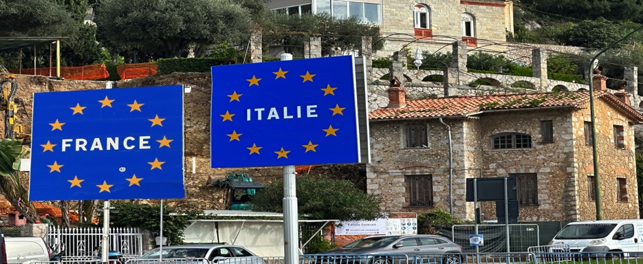
Crossing the Italian border, I followed the Via Aurelia to Ventimiglia, at the mouth of the Roya River, a symbolic point of the Italian Riviera.
The journey concluded at the train station. With a little time before departure, I cycled through a park along the river, reflecting on the past weeks of travel. My bicycle had been a loyal companion throughout the adventure.
The return trip involved three trains, a succession of coasts observed from the window, moving at a pace far faster than the rhythm I had grown accustomed to on the road.
Late in the afternoon, I arrived at Milan Centrale, greeted by familiar faces and warm embraces.
And so, this incredible adventure came to an end – but, as every traveler knows, the end of one journey is only the beginning of the next. I can’t wait to set off again, somewhere, sometime, always on two wheels.
📌 Information with GoPro footage
• Region 🌍 : Provence-Alpes-Côte d’Azur (France) → Liguria / Italian Riviera (Italy)
• Main locations 🏘 : Villeneuve-Loubet → Nice → La Turbie → Roquebrune-Cap-Martin → Menton → Ventimiglia
• Distance 🚴 : ~ 58.8 km
• Total time ⏱️ : ... hours, including scenic and photo stops
• Terrain 🛣 : Paved roads, cycle paths, challenging climbs (Grande Corniche and La Turbie) and scenic descents
• Direction 🧭 : West → East along the Mediterranean coast
• Route map📍: View the map
🇫🇷 Stage 8.4 I Day 58: Hotel Cheval Blanc, Arles → Kyriad Direct Hotel, Brignoles, France
I woke up beneath a clear blue sky and, after breakfast, loaded the panniers onto the bike rack. Leaving Arles behind, I chose inland roads to avoid retracing my outbound route. The scenery was beautiful green and rural as I passed through the small town of Saint-Martin-de-Crau.
The road began to climb gently through Pélissanne, continued past Lançon-Provence, and eventually led me to Aix-en-Provence, a lively university city in the Provence-Alpes-Côte d’Azur region. After leaving Aix, rolling hills and small villages followed one another beneath a sky that shifted between cloudy and clear.
From Fuveau to Pourrières, the landscape became truly spectacular: postcard-perfect countryside, quiet roads, vineyards, and sweeping views of the Sainte-Victoire massif. Riding through small villages such as Tourves, the journey felt almost solitary, with green hills and undulating landscapes stretching to the horizon.
In the evening, I reached Brignoles, in the Var department, and checked in at the Kyriad Direct Hotel. After settling in, I took a short walk, found a supermarket, and returned to my room for dinner, accompanied by music on my iPad—some tracks by Gianna Nannini. I ended the day with my usual routine: sending messages to family and friends and planning the next stage before falling asleep.
📌 Information with GoPro footage
• Region 🌍 : Provence, France (Departments: Bouches-du-Rhône and Var)
• Main locations 🏘 : Arles → Saint-Martin-de-Crau → Pélissanne → Lançon-Provence → Aix-en-Provence → Fuveau → Pourrières → Tourves → Brignoles
• Distance 🚴 : ~134 km
• Total time ⏱️ : ... hours, including scenic and photo stops
• Terrain 🛣 : Hilly, quiet inland roads with some rolling sections
• Direction 🧭 : East → North-East
• Route map📍: View the map
zz