

Cycle Tour | Circumnavigation of the Iberian Peninsula: from the Mediterranean to the Atlantic and Back – Stage #6
🇪🇸 Stage 6: From Ayamonte (Portugal) to Tarifa via Huelva, Seville & the Strait of Gibraltar
Southern Spain: Andalusia – Sun, Wind, and History
Crossing Ayamonte into Spain, I entered Andalusia, a land of vibrant culture, whitewashed villages, and endless sunshine. The road led me through Huelva, where the Atlantic breeze carried the scent of salt and citrus groves.
In Seville, the city’s heartbeat was unmistakable: the grandeur of the Alcázar, the imposing Cathedral, the labyrinthine alleys of Santa Cruz, the Plaza de Toros de la Real Maestranza de Caballería, and the Plaza de España icons of Andalusian history and charm turned every stop into a feast for the senses. Cycling through sunlit streets, I felt fully immersed in the rhythm and soul of the region.
Continuing south, I approached Tarifa, the southernmost point of Europe. With the wind at my back and the African continent visible across the Strait of Gibraltar, this stretch became a powerful and exhilarating milestone the symbolic southern apex of my Iberian circumnavigation.
🇪🇸 Stage 6.1 I Day 39: Hostal Toscano, San Juan del Puerto (Huelva) → Camping Villsom, Dos Hermanas (Seville), Spain
I had an early breakfast in my room at Hostal Toscano, waiting for the first light of day before setting off under a clear sky. The road from San Juan del Puerto into the province of Huelva led me through vast stretches of farmland to my first stop: Niebla. Perched on a hill above the Río Tinto, this ancient village surprised me with its extraordinary Moorish walls, still remarkably intact, and a quiet, unspoiled historic center of winding alleys and small squares. It was a delightful, uncrowded discovery far beyond my expectations.
From there I continued through the familiar landscapes of rolling countryside, skirting villages such as Villarrasa and Villalba del Alcor. The wind swept across the fields, making the tall plants sway above me, while I shared the road with many local cyclists. I passed through Manzanilla, surrounded by farmland, then Escacena del Campo, before entering the province of Seville.
Here the countryside stretched endlessly, with ripened cereals and herbaceous crops painting the landscape in shades of gold and straw. I rode past Castilleja del Campo and Huévar del Aljarafe, then followed a beautiful cycle path through Sanlúcar la Mayor and Espartinas.
The route continued smoothly via Camas and Triana Oeste, before crossing the Puente de la Señorita and entering Seville, the capital of Andalusia.
The city’s excellent cycling network allowed me to explore the historic center with ease. Highlights included the Alcázar, the Cathedral with the Giralda, the Palacio de San Telmo, the Santa Cruz district, the Plaza de Toros, and the colorful neighborhood of Triana.
When I reached Parque María Luisa, it felt like stepping onto a film set. At its heart lies Plaza de España, designed by architect Aníbal González.
This magnificent square, with its semicircular building of Andalusian brick, marble, and ceramics, left me speechless. Along the curved façade, tiled alcoves display mosaics and maps of Spain’s provinces, each decorated with coats of arms and historical scenes.
The towers, arcades, ceramic bridges, and the calm canal where tourists rowed small boats created an atmosphere that was both majestic and serene. The beauty of the square was overwhelming; I didn’t want to leave, certain it was one of the most spectacular places I had ever seen.
Finally, I cycled another 15 km south to Dos Hermanas, where I checked in at Camping Villsom Sevilla.
After pitching my tent, I bought dinner at the supermarket near the campsite. Although I could have returned to Seville for an evening stroll, I chose instead a quiet walk around the campsite, admiring the pool and restaurant before turning in for the night.
📌 Route information and footage with GoPro
• Region / Area 🌍 : Andalusia, Provinces of Huelva and Seville
• Main Locations 🏘 : San Juan del Puerto → Niebla → Villarrasa → Villalba del Alcor → Manzanilla → Escacena del Campo → Castilleja del Campo → Huévar del Aljarafe → Sanlúcar la Mayor → Espartinas, Camas → Triana, Seville →Dos Hermanas
• Distance 🚴 : ~101 km
• Total Time ⏱️ : [.....], including scenic and photo stops
• Terrain 🛣️ : Cycle paths, paved roads, agricultural landscapes, urban sections
• Direction 🧭 : North → South
• Route Map 📍: View the map
🇪🇸 Stage 6.2 I Day 40: Villsom Camping Sevilla (Seville) → Camping Playa Las Dunas, El Puerto de Santa María (Costa de la Luz), Spain
I woke up this morning under a completely blue sky. After taking down the tent and loading the panniers onto my bike, I headed to the campsite restaurant for breakfast. A cheerful, friendly lady served me a cappuccino and toasted bread with tomato jam simple, but the perfect start to the day.
Outside, near where I had parked my bike by the entrance, I met an English cyclist who was also on a long-distance journey. Unfortunately, he had been stuck there for several days waiting for a spare part to arrive from England. We wished each other good luck before heading off on our separate ways.
Leaving Camping Villsom in Dos Hermanas, in the Lower Guadalquivir region, I initially followed a flat cycle path that soon connected to the wider Andalusian road network also pleasantly flat and with plenty of space for cyclists.
The ride unfolded through landscapes dominated by farmland, with vast cotton fields shimmering in the sunlight. Not far away lies Doñana National Park, one of Europe’s most important wetland habitats, stretching across the provinces of Huelva, Seville, and Cádiz along the right bank of the Guadalquivir River.
I followed a route skirting a series of towns: Los Palacios y Villafranca, Las Cabezas de San Juan with its whitewashed houses, then Lebrija, Trebujena, and finally Sanlúcar de Barrameda on the left bank of the Guadalquivir, opposite Doñana. Entering each town would have cost me too much time, so I admired them from the road and continued on.
The scenery remained extraordinary: corridors of cotton plantations stretched to the horizon, their white bolls sparkling in the wind, while the road itself was almost deserted. Along this quiet, peaceful stretch, I eventually reached El Puerto de Santa María, a town on the Costa de la Luz overlooking the Bay of Cádiz.
El Puerto is historically linked to Christopher Columbus, who prepared some of his voyages to the Americas here. For me, it also brought a sense of déjà vu, as I had visited it before during a cycling trip commemorating the 500th anniversary of Columbus’s first expedition.
My destination for the night was Camping Playa Las Dunas, nestled among the pine forests of the Dunas de San Antón. After checking in, I pitched my tent on sandy ground, stored my gear, and went out to explore. The campsite was vast, with winding paths and pitches harmoniously integrated into the surrounding nature. In the low season, the shop, café-restaurant, and swimming pools were closed, which only added to the calm and almost isolated atmosphere.
I got a bit lost wandering around the large campsite, but eventually found the exit and reached the seafront at Playa La Puntilla a long, golden beach lined with restaurants. Later, I stopped at a supermarket and then returned to my tent for dinner, surrounded by the quiet of nearly empty pitches.
As evening fell, I checked tomorrow’s route on Google Maps and Komoot, sent a few messages to family and friends, and finally let exhaustion carry me to sleep, lulled by the calm of a pine-scented night.
📌 Route information and footage with GoPro
• Region / Area 🌍 : Andalusia, Provinces of Seville and Cádiz
• Main Locations 🏘 : Dos Hermanas → Los Palacios → Villafranca → Las Cabezas de San Juan → Lebrija → Trebujena → Sanlúcar de Barrameda → El Puerto de Santa María
• Distance 🚴 : ~120 km
• Total Time ⏱️ : [.....], including scenic and photo stops
• Terrain 🛣️ : Flat roads and cycle paths, agricultural sections, quiet secondary roads
• Direction 🧭 : Southbound, along the Costa de la Luz
• Route Map 📍: View the map
🇪🇸 Stage 6.3 I Day 41: Camping Playa Las Dunas, El Puerto de Santa María → Hostal El Levante, Tarifa (Costa de la Luz), Spain
Another sunny day began quietly among the fragrant coastal pine trees where I had pitched my tent the night before. My morning routine was a little incomplete today — no breakfast, as the bar just outside the campsite was still closed when I set off a bit too early.
Not far from the exit, I stopped to photograph my bike leaning against a bench. Behind it, the words “El Puerto de Santa María” were framed inside a large heart. Since I truly love my bike, it felt like the perfect photo as if the city itself had left a message of affection for my faithful travel companion.
From here, I could have taken the Catamarán Bahía de Cádiz, a 30-minute ferry crossing the bay that also accepts bicycles. However, as tickets are limited and must be booked in advance, I chose to follow the coast by bike instead a decision that proved more than rewarding.
The cycle path led me along Cádiz’s seafront, where the morning light shimmered across Playa La Puntilla. The Atlantic was calm and crystal clear, dotted with moored boats. A long bridge stretched toward the horizon, while whitewashed houses glowed in the background.
After passing through the historic center of El Puerto de Santa María, just a few kilometers further on I encountered a striking white sculpture of a cyclist bearing a plaque that read “Glorieta de los Ciclistas”, likely a tribute to a local Tour de France victory.
Soon after, the road guided me into the serene beauty of the Bahía de Cádiz Natural Park, one of Europe’s most important coastal wetlands. Though the stretch was brief, it was enchanting, bordered by pines, low shrubs, and aromatic vegetation typical of the coastline.
Continuing south, I began to spot the black silhouettes of the Osborne Bulls once giant billboards advertising Brandy de Jerez, now preserved as cultural icons of Spain. The road started to gently rise and fall through fields and rolling hills dotted with wind turbines. On a hill near Puerto Real, facing Cádiz across the bay, an Osborne Bull stood proudly against the sky.
The afternoon carried me past Conil de la Frontera and the hilltop village of Vejer de la Frontera, before finally reaching Tarifa, the southernmost point of continental Europe. Here, where the Atlantic Ocean meets the Mediterranean Sea, the Isla de las Palomas stretches into the water, connected to the mainland by a narrow isthmus marking this spectacular geographical boundary.
My accommodation for the night was just outside Tarifa: Hostal El Levante, about two kilometers from town. It had the charm of a classic roadside motel, but far cozier, surrounded by greenery and silence. The terrace café was closed for the low season, yet it felt like a safe and peaceful place to leave my bike.
After check-in and organizing my gear, I went out for a short evening walk, something I always love after a long day in the saddle. Instead of heading into Tarifa which I’ll explore tomorrow I walked about 500 meters to Playa de los Lances, its fine white sand stretching for seven kilometers toward Tarifa and the Campo de Gibraltar, bathed in the soft light of dusk.
Nearby, I found El Rancho, a welcoming restaurant known for local meats thankfully, the menu also included a hearty vegetarian burger, perfect for dinner.
Back in my room, I opened Komoot and Google Maps to study the route for the following day. With a thrill of excitement, I realized that tomorrow awaits the Strait of Gibraltar, the true gateway into a new chapter of this journey along Spain’s eastern coast. With that thought, I drifted off to sleep.
📌 Route information and footage with GoPro
• Region / Area 🌍 : Andalusia, Spain
• Main Locations 🏘 : El Puerto de Santa María → Conil de la Frontera → Vejer de la Frontera → Tarifa
• Distance 🚴 : ~127 km
• Total Time ⏱️ : [.....], including scenic and photo stops
• Terrain 🛣️ : Paved flat and rolling roads, coastal cycle paths, gentle climbs and descents, short secondary gravel sections
• Direction 🧭 : North → South along the Costa de la Luz
• Route Map 📍: View the map
🇪🇸 Stage 6.4 I Day 42: Hostal El Levante, Tarifa (Costa de la Luz) → San Luís de Sabinillas (Costa del Sol Occidental), Spain
I woke up to a bright, sunny sky, and a wave of relief washed over me. After days of rain in northern Spain, real summer finally seemed to have arrived, now that I was in the south along the Costa de la Luz.
After retrieving my bicycle and loading the panniers, I was ready to leave. Just as I was about to get on the bike, the two owners of the hostal father and son came over to ask if I had enjoyed my stay.
I told them I had loved it, especially because the place was surrounded by greenery and each room had its own private entrance, almost like a small apartment. They thanked me warmly, and with smiles and goodbyes, I set off again.
Eight kilometers later, a sign announced Tarifa, the windy Andalusian town in the province of Cádiz, famous as the wind capital of Europe and an international hotspot for windsurfing and kitesurfing.
After so many kilometers around the Iberian Peninsula, I finally reached Punta de Tarifa, the southernmost point of continental Europe, where land comes within just 14 km of Morocco.
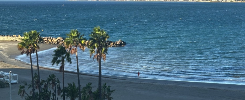
The seafront was calm and quiet. A few people were walking, others jogging. I stopped to photograph Playa de los Lances, a vast and magnificent beach of fine white sand. Despite its reputation for wind sports, the sea was calm and the beach almost empty a true slice of paradise.
Leaving Punta de Tarifa behind, the road began to climb gently, winding through the Parque Natural del Estrecho, where the Mediterranean Sea meets the Atlantic Ocean. From the panoramic viewpoints, at around 330 meters above sea level, the scenery was breathtaking, with the coastline fading into the haze.
From one viewpoint, I admired Tarifa, the African coast across the Strait of Gibraltar, and the invisible line where the two seas merge. The following descent led me toward Algeciras, a lively port city, and then on to La Línea de la Concepción, on the border with Gibraltar.
Crossing Gibraltar was a surreal experience: cars passed through without stopping, while I was asked to show my documents. The main road crosses the airport runway, and I cycled straight across it, taking photos of the city, the waterfront, and the Rock of Gibraltar, home to the Barbary macaques, the only wild primates in Europe.
After a short break for a cold Coca-Cola, I re-entered Spain and continued along the EuroVelo 8 coastal route, with constant views of the imposing Rock and the Atlantic Ocean.
I crossed a small nature reserve along the Guadiaro estuary, then passed through San Roque, before finally reaching my destination: San Luís de Sabinillas, on the Costa del Sol Occidental.
In the afternoon, once settled into a cozy Bed & Breakfast, I took a walk along the beach and the quiet promenade. The marina was lively with bars, tapas spots, and restaurants. I had dinner at an Italian pizzeria, where the owner originally from Italy was especially friendly, as were the locals.
Back in my room, I followed my usual evening routine: charging devices, messaging family and friends, and finally falling asleep, thinking about the excitement of continuing the next day along the beautiful southern coast of Spain.
📌 Route information and footage with GoPro
• Region / Area 🌍 : Costa de la Luz (Cádiz Province) → Costa del Sol Occidental, Spain
• Main Locations 🏘 : Tarifa → San Luís de Sabinillas
• Distance 🚴 : ~105 km
• Total Time ⏱️ : [.....], including scenic and photo stops
• Terrain 🛣️ : Asphalt roads, coastal cycle paths, panoramic climbs
• Direction 🧭 : East / South-East along the coast
• Route Map 📍: View the map