

🇵🇹 ➡️ 🇪🇸 Stage 5 – From Northern to Southern Portugal, along the Algarve coast and hinterland (Porto → Vila Real de Santo António)
Southern Portugal & Algarve – Golden Beaches
I resumed my adventure along the Portuguese coast, cycling past golden beaches, dramatic cliffs, and picturesque villages. From the tranquil northern shores to the fiery sunsets of the south, every kilometer along the Coastal Route of the Portuguese Camino offers unforgettable landscapes. Villages like Lagos and Tavira showcase the history, architecture, and natural beauty of the Algarve, with cobbled streets, rugged coastlines, and hidden coves.
The Portuguese section ends at Tavira: a ferry crosses the Guadiana River, taking me to Ayamonte in Spain, ready to continue the journey through Andalusia and along the southern coasts of the Iberian Peninsula.
Cycle Tour | Circumnavigation of the Iberian Peninsula: from the Mediterranean to the Atlantic and Back – Stage #5
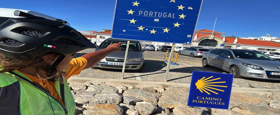
🇵🇹 Stage 5.7 I Day 34: Parque de Campismo Orbitur, Corsta de Capirca - Alojamento Local "O Avellino" (Setubal), Carvalhal, Portugal
Comin Soon
📌 Route information and footage with GoPro
• Region / Area 🌍 :
• Main Locations 🏘 :
• Distance 🚴 : ~95.2 km
• Total Time ⏱️ : [.....], including scenic and photo stops
• Terrain 🛣️ :
• Direction 🧭 :
• Route Map 📍: View the map
🇵🇹 Stage 5.8 I Day 35: Alojamento Local "O Avellino" (Setubal), Carvalhal - Azul Alentejano Hotel, Cercal, Portugal
Comin Soon
📌 Route information and footage with GoPro
• Region / Area 🌍 :
• Main Locations 🏘 :
• Distance 🚴 : ~95.2 km
• Total Time ⏱️ : [.....], including scenic and photo stops
• Terrain 🛣️ :
• Direction 🧭 :
• Route Map 📍: View the map
🇵🇹 Stage 5.9 I Day 36: Azul Alentejano Hotel, Cercal do Alentejo - Vibes Guest House, Logos in the western part of the Algarve, Portugal
Comin Soon
📌 Route information and footage with GoPro
• Region / Area 🌍 :
• Main Locations 🏘 :
• Distance 🚴 : ~95.2 km
• Total Time ⏱️ : [.....], including scenic and photo stops
• Terrain 🛣️ :
• Direction 🧭 :
• Route Map 📍:View the map
🇵🇹 ➡️ 🇪🇸 Stage 5.11 I Day 38: Camping Rio Formosa, Tavira, Portugal to Ferry fom Vila Real de Santo António I Portugal to Ayamonte, Spain
Comin Soon
📌 Route information and footage with GoPro
• Region / Area 🌍 :
• Main Locations 🏘 :
• Distance 🚴 : ~91.9 km
• Total Time ⏱️ : [.....], including scenic and photo stops
• Terrain 🛣️ :
• Direction 🧭 :
• Route Map 📍: View the map
🇵🇹 Stage 5.10 I Day 37: Vibes Guest House, Logos in the Algarve region - Camping Rio Formosa, Tavira, Portugal
Comin Soon
📌 Route information and footage with GoPro
• Region / Area 🌍 :
• Main Locations 🏘 :
• Distance 🚴 : ~131.1 km
• Total Time ⏱️ : [.....], including scenic and photo stops
• Terrain 🛣️ :
• Direction 🧭 :
• Route Map 📍: View the map
🇵🇹 Stage 5.2 | Day 30: Salgueiros Camping Park, Vila Nova de Gaia → Camping Municipale di Mira, Praia de Mira, Portugal
This morning I woke up to find that the rain had finally stopped. The night had been damp but gentle, just enough to leave the air fresh and clean. I quickly packed up the tent, loaded my bike, and headed toward the Vila Nova de Gaia seafront. At a café with an ocean view, I enjoyed a relaxed breakfast before setting off.
The EuroVelo 1 guided me south along a mix of bike paths, shared lanes, and short stretches of road. The ride was easy and flat, with the Atlantic Ocean as constant company.
After passing Espinho, I stopped at Silvalde, where by coincidence I found a Burger King. It wasn’t planned, but it turned out to be a convenient lunch stop. While eating, I spread my tent on a railing in the parking lot; by the time I finished, the sun had already dried everything.
From there, the route took me through Maceda, a quiet village surrounded by tall pine trees and endless beaches. Morning clouds had cleared to reveal a blue sky, and I cycled through a series of small villages before following a path along the Aveiro Lagoon, with sunlight sparkling on its vast waters.
I skirted the city of Aveiro (its canals and colorful moliceiros will have to wait for another visit) and crossed the Juncal Ancho Bridge into Ílhavo. Passing through Gafanha da Encarnação and Gafanha do Carmo, I found a quiet road lined with pines. The air was filled with the scent of resin, broken only by the rhythm of my wheels.
A final bike path led me to Praia de Mira, a fishing village on the Silver Coast, framed by the ocean and the calm Barrinha Lagoon. At the Camping Municipale de Mira, nearly empty in low season, I could choose my spot in the shade of the trees. After pitching the tent, I took a walk along the seafront under a light evening drizzle and found a cozy restaurant for dinner. The kindness of the staff made me linger, enjoying both the food and the peaceful atmosphere.
Later, I returned to the tent under the rain, with the fresh scent of wet earth and pines in the air. Warm and dry inside my sleeping bag, I listened to the steady pitter-patter of rain on the canvas until I fell asleep.
📌 Route information and footage with GoPro
• Region / Area 🌍 : Portugal Coast → Silver Coast
• Main Locations 🏘 : Vila Nova de Gaia → Espinho → Silvalde → Maceda → Aveiro → Ílhavo → Gafanha da Encarnação → Gafanha do Carmo → Praia de Mira
• Distance 🚴 : ~101 km
• Total Time ⏱️ : [.....], including scenic and photo stops
• Terrain 🛣️ : Flat, mix of bike paths and secondary paved roads
• Direction 🧭 : North → South
• Route Map 📍: View the map
🇵🇹 Stage 5.3 | Day 31: Mira Municipal Camping Park, Praia de Mira → Camping Orbitur - S. Pedro de Moel, Marinha Grande, Portugal
This morning I woke up to a pleasant surprise: the rain had finally stopped. After packing up all my gear, I rode a short distance to the fishing village of Praia de Mira, stopping at a café for breakfast.
Just beyond the village lay Barrinha, a vast freshwater lagoon fed by a small stream. Little bridges crossed its edges, and colorful boats were moored along the banks—a lively scene worth a quick photo before continuing.
From Praia de Mira, I followed the EuroVelo 1 – Atlantic Coast Route, a mix of quiet secondary roads and flat bike paths. The ride south to Quiaios was smooth and steady, flanked by dunes and stretches of coastal pine forest. After a gentle inland climb, the road descended to Figueira da Foz.
Crossing the Edgar Cardoso Bridge, the city’s only crossing over the Mondego River, was one of the highlights of the day. From the bridge, the view of the river and city opened in every direction.
South of Figueira, the route entered Carriço, where a perfectly smooth, traffic-free bike path led me into the heart of the Mata Nacional do Urso (National Bear Forest). Centuries ago, the timber from this vast pine forest supplied Portuguese caravels; today it offers a peaceful ride immersed in pristine nature.
The trail then took me to Lagoa da Ervedeira, a freshwater lagoon hidden among the Leiria woods. From there, I passed under the “Bem-Vindo” sign welcoming me to Vieira de Leiria. The path meandered through dunes and dry vegetation, giving the landscape a quiet, almost desert-like feel.
Soon I returned to the coast, admiring Praia do Pedrógão (South), a wild beach hammered by the waves. Further along, I reached Praia da Vieira, where the Lis River meets the Pinhal de Leiria pine forest.
The scenery became increasingly striking as I approached the Penedo da Saudade lighthouse, standing proudly on the cliff, overlooking the golden sands of Praia da Concha. From there, the ride to São Pedro de Moel, a small coastal resort nestled between forest and sea, was brief.
For the night, I stayed at Orbitur S. Pedro de Moel, a peaceful campsite shaded by pines and near the water. Even in low season, it offered everything: restaurant-bar, small market, pools with slides, playground, and bungalows. I picked a quiet pitch for my tent and took a short walk in the village.
Later, I bought dinner at the market and ate in the main hall, recharging my equipment. Tomorrow the road will take me further south, toward Nazaré, home of legendary surf and the world’s biggest waves.
📌 Route information and footage with GoPro
• Region / Area 🌍 : Silver Coast, Leiria District, Portugal
• Main Locations 🏘 : Praia de Mira → Quiaios → Figueira da Foz → Carriço → Lagoa da Ervedeira → Vieira de Leiria → Praia do Pedrógão → Praia da Vieira → São Pedro de Moel
• Distance 🚴 : ~103 km
• Total Time ⏱️ : [.....], including scenic and photo stops
• Terrain 🛣️ : Mostly flat, bike paths, quiet secondary roads, short climbs
• Direction 🧭 : North → South along the Atlantic coast
• Route Map 📍: View the map
🇵🇹 Stage 5.4 | Day 32: Camping Orbitur – S. Pedro de Moel, Marinha Grande → Quebra Costas Rooms, Torres Vedras, Portugal
This morning I woke up under an overcast sky. After leaving the campsite and riding just a few kilometers, I joined the coastal bike path heading south, with the Atlantic Ocean constantly by my side.
The route began in São Pedro de Moel and passed through Praia de Paredes da Vitória, a beach in Pataias known for its wide stretch of sand, ideal for surfing, bodyboarding, and paragliding. I stopped there for breakfast at a seaside café before continuing toward the beautiful town of Nazaré.
Today’s ride was a mix of bike paths and paved roads, crossing some of the most stunning landscapes along the western Portuguese coast: long flat sections broken up by challenging climbs, including the steep ascent to Sítio, Nazaré’s upper district perched on the cliffs. From the top, the view over the town and the iconic Praia do Norte was spectacular. The cobblestoned main square was alive with stalls, food trucks, and restaurants. Even though the giant waves were not in season, the place remained one of the most impressive I’ve ever visited.
From Sítio, I descended back into town, passing through Nazaré Seaside and Praia da Nazaré, where several historic fishing boats were displayed on the sand—a reminder of the town’s deep fishing heritage. While taking photos, I met a group of Franco-Canadians who had noticed the Italian–Canadian flag on my bike. We exchanged a few stories before saying goodbye and riding on into the mist.
The road then wound through rolling coastal hills, with another demanding climb toward Serra da Pescaria. From the top, the Atlantic stretched endlessly in every direction. A long descent brought me to a viewpoint overlooking the crescent-shaped bay of São Martinho do Porto and the surrounding green countryside. After a short stop and a few photos, I rolled into town, where the 3rd São Martinho do Porto Triathlon had just ended, and then continued past Salir do Porto.
The next section led me onto quiet secondary roads through the countryside, passing Tornada, Calhas da Rainha, and Óbidos. Perched on a hill, the medieval castle of Óbidos, dating back to the 12th century and considered one of the Seven Wonders of Portugal, dominated the skyline. Today, it houses a luxury hotel.
From there, a sequence of ups and downs took me through Vale Covo, Outeiro da Cabeça, and Ramalha, before I finally reached Torres Vedras, a small inland city about 15 kilometers from the coast. I checked in at Quebra Costas Rooms Torres Vedras, a charming place just five minutes from the city center.
This is always one of my favorite moments of the day: arriving after hours on the bike, settling in, and then heading out on foot to explore. I wandered through the narrow cobbled streets of the historic center, descending from the 13th-century castle. Part of the Lines of Torres Vedras, the castle belonged to the defensive network built to protect Lisbon during the Peninsular War.
Beyond the castle, I found Gothic fountains, quiet squares, ancient churches, and small local markets. I chose a cozy restaurant for dinner and enjoyed a peaceful evening, far from tourist crowds. Back in my room, I ended the day by planning tomorrow’s route—another day, another adventure.
📌 Route information and footage with GoPro
• Region / Area 🌍 : Silver Coast, Leiria District, Portugal
• Main Locations 🏘 : São Pedro de Moel → Nazaré, São Martinho do Porto → Óbidos →Torres Vedras
• Distance 🚴 : ~104 km
• Total Time ⏱️ : [.....], including scenic and photo stops
• Terrain 🛣️ : Paved roads, bike paths, demanding climbs and descents
• Direction 🧭 : North → South
• Route Map 📍: View the map
🇵🇹 Stage 5.6 | Day 33: Quebra Costas Rooms, Torres Vedras → Parque de Campismo Orbitur, Costa da Caparica, Portugal
This morning I opened the curtains of my room to find a beautiful sunny day, perfect for cycling. I had breakfast in the room with supplies I had bought the night before, then loaded the panniers onto the bike racks and set off through the cobblestone streets of central Torres Vedras.
The night before, during an evening walk, I had met a cyclist who gave me some advice: some riders love the inland route for its rural charm and demanding climbs, while others prefer the coast for its panoramic ocean views. I chose the inland option, eager to change scenery and explore a quieter, less touristy countryside.
I followed the N8 road, a peaceful route winding through beautiful farmland. The day unfolded among rolling green hills, with steep climbs and descents cutting through agricultural landscapes. Wind turbines dotted the hills near small villages such as Turcifal, Vila Franca do Rosário, and Malveira, creating a surreal contrast between tradition and modernity.
As I moved through these rural areas, I passed charming countryside villages. Unfortunately, recent wildfires had left burned trees along parts of the route, and the persistent smell of smoke was a reminder of nature’s fragility. I stopped for a snack at a gas station in Asseiceira Pequena, then continued through Guerreiros and Loures, enjoying the quiet beauty of the countryside.
At one point I set Google Maps toward Lisbon. The route led me onto a brutally steep climb, rising from 20 to 150 meters above sea level. Riding was nearly impossible; I had to push the bike by hand, moving carefully—one wrong step and the bike could have slipped downhill. From the top, however, the view was worth every effort: the winding road I had just climbed, green hills, and scattered houses glowing in the sunlight.
Descending from Quinta da Várzea, the road brought me into the residential hillside neighborhood of Estrela in Lisbon. I passed the romantic Jardim da Estrela, an English-style park, then continued along Rua da Lapa, enjoying breathtaking views over the Tagus River, framed by colorful, perpendicular streets. The steep paved descents were challenging; in some sections I had to walk the bike, relying heavily on the brakes.
From Lapa, with its grand buildings and villas, the route led me down toward the riverfront. Google Maps had tested me once again, but the reward was spectacular: the Tagus River opened up before me, lined with a beautiful cycling path and the 25 de Abril Bridge stretching across the horizon—instantly reminding me of the Golden Gate Bridge from my journey along the Pacific coast.
I eventually reached the historic district of Belém, rich in Portugal’s maritime heritage. From there, I took a ferry to Costa da Caparica. On board, I met Giuseppe, a local cyclist who regularly uses the ferry to commute to Lisbon. He shared a few useful tips before we parted ways at Estação Fluvial do Porto Brandão.
A few kilometers later, I arrived at my destination for the day: Parque de Campismo Orbitur. After checking in and pitching the tent, I explored the campsite. There were several bungalows and a beautiful beach with gentle waves, where a handful of surfers were enjoying the Atlantic waters—the perfect ending to a demanding yet deeply rewarding day on the bike.
📌 Route information and footage with GoPro
• Region / Area 🌍 : Silver Coast → Lisbon District, Portugal
• Main Locations 🏘 : Torres Vedras → Estrela → Belém → Costa da Caparica
• Distance 🚴 : ~74.6 km
• Total Time ⏱️ : [.....], including scenic and photo stops
• Terrain 🛣️ : Paved roads, steep climbs, cycle paths Direction 🧭 : North → South
• Direction 🧭 : North → South
• Route Map 📍: View the map
🇵🇹 Stage 5.1 | Day 29: Campismo de Belinho, Belinho → Parque de Campismo de Salgueiros, Vila Nova de Gaia, Portugal
This morning the sky was a pale yellow, tinged with smoke from distant wildfires. While rolling up my sleeping bag with the tent open to the fresh air, one of the campsite cats kept me company for a few quiet minutes.
After loading my bike and preparing my gear, I had breakfast at the outdoor tables, surrounded by cats who gathered like old companions. When it was finally time to leave, two of them “escorted” me to the gate, as if to say goodbye and wish me a good journey.
The first part of the route ran along a quiet and flat road from Belinho to Esposende. There, I noticed Bikeseven Esposende (KTM), and since my bike gears were giving trouble, I stopped. Paul, the owner and cyclist, fixed everything quickly and refused payment with a smile: “Happy riding!” A small act of kindness I won’t forget.
Continuing, I passed the Memorial Paulo Gonçalves, an imposing 5.5-meter sculpture made of 27,500 mechanical parts in memory of the Portuguese rider. Crossing the D. Luís Filipe metal bridge, I admired the Cávado River winding toward the Atlantic before arriving at the coastal town of Fão.
Heading south, the route took me past Póvoa de Varzim and Vila do Conde, crossing the Ave River. In the afternoon, at Leça do Balio, I took a short break at McDonald’s, where the cashier added an ice cream to my order a small surprise on a warm day.
In the distance, the hills of Porto rose ahead, with terracotta rooftops and the wide Douro River. The highlight was crossing the Dom Luís I Bridge, the double-deck metal bridge offering spectacular views of Porto and Vila Nova de Gaia, with its wine cellars and old stone houses.
Arriving in Vila Nova de Gaia, I reached the Parque de Campismo de Salgueiros, just 6 km from downtown Porto. After setting up my tent and stocking up on food at a nearby supermarket, I explored the coastal paths and watched the evening light fade over the beaches.
It was a day full of cats, kind people, and unforgettable views of the river, a reminder of how small moments can turn a journey into a story to remember.
📌 Route information and footage with GoPro
• Region / Area 🌍 : Braga, Porto, Vila Nova de Gaia, Portugal
• Main Locations 🏘 : Belinho → Esposende → Fão → Póvoa de Varzim → Vila do Conde → Leça do Balio → Porto → Vila Nova de Gaia
• Distance 🚴 : ~78.0 km
• Total Time ⏱️ : [.....], including scenic and photo stops
• Terrain 🛣️ : Flat paved roads, coastal bike paths, slightly hilly toward Porto
• Direction 🧭 : Northwest → South, along the Atlantic coast
• Route Map 📍: View the map
🇵🇹 ➡️ 🇪🇸 Stage 5 Algarve Coastal Route from West to East to the Spanish Border in the City of Ayamonte
From the wild Atlantic coast of the Algarve to the Spanish border, through ocean views, charming villages, and scenic cycling paths 🌊🚴♀️
In this stage, I will cycle along the beautiful southern coastline of Portugal, which I already knew, having covered it on another cycling trip. Nevertheless, it was truly enjoyable to retrace it once again.
In this stretch runs the Atlantic Coast Route – the Ecovia Litoral, which is part of EuroVelo 1 in the Algarve region.
The 220-kilometer cycle path follows the entire coastline of the Algarve region in southern Portugal, connecting from the west at Cabo de São Vicente (Sagres) to the east at Vila Real de Santo António, on the Spanish border.
Upon arriving in the western part of the Algarve, the route crosses varied terrain, from flat cycle paths to rolling hills and quiet local roads, immersed in a variety of Mediterranean landscapes and scenic coastal boulevards.
The route passes through the towns of Lagos, Portimão, Lagoa, Almancil, Faro, Olhão, Tavira, and finally reaches Vila Real de Santo António, located in the eastern Algarve.
From there, I took a short 15-minute ferry across the Guadiana River to the town of Ayamonte, which belongs to the province of Huelva, Andalusia, Spain.