

Scenic Gold Rush Bike Tour – Coast Mountains & Okanagan Valley Loop in British Columbia, Canada
The Scenic Gold Rush Bike Tour – Loop through the Coast Mountains and the Okanagan Valley is a journey that crosses British Columbia like a continuous line between completely different worlds: from the ocean to the mountains, from fertile valleys to the semi-deserts of the interior, all the way to alpine lakes and back to the coast.
In 10 days of cycling plus 1 day of exploration, covering approximately 1,306 km, this fully independent itinerary follows our own rhythm, shared with a friend on her first long-distance cycling journey, guided by endless horizons that accompany every pedal stroke.
We start in Vancouver, a coastal city on the Pacific Ocean, with our bikes ready and a strong sense of adventure. We leave behind modern architecture immersed in nature and, gradually crossing the suburbs, begin following Scenic Route 7 (Lougheed Highway) along the majestic Fraser River.
We ride through Coquitlam, Maple Ridge, Mission, Agassiz, and Kent, while the Fraser Valley slowly unfolds before us: gentle green hills, orchards, and shimmering water reflections accompany the first kilometers, alive with waterbirds and glimpses of wildlife.
Arriving in Hope, the landscape changes character. This small town, set between towering mountains, is an open-air gallery: numerous wooden sculptures tell the story of British Columbia through pioneers, wildlife, and local legends. Hope is known as the “Chainsaw Carving Capital of the World”, and among the most iconic pieces stands the famous Rambo statue, connected to the film First Blood, which was shot here.
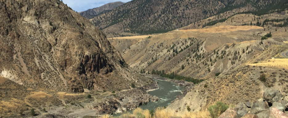
But Hope is also a geographical transition point: the valley gives way to the Fraser Canyon, where the landscape becomes narrower and wilder. Just beyond, we encounter the Hope Slide, one of the largest landslides in Canadian history.
Continuing toward Boston Bar, we reach the spectacular Hell’s Gate, where the Fraser River squeezes between steep rock walls, creating powerful and dramatic rapids. Along this section, we pass historic places such as Yale, an old Gold Rush center, the Alexandra Bridge, and the Tuckkwiowhum Heritage Village, a testimony to local Indigenous cultures.
Leaving the canyon behind, we enter the heart of the Cascade Mountains through Manning Provincial Park. Forests become denser, streams clearer, and the environment more wild. The road climbs up to Allison Pass (1,342 m), the highest elevation point of the journey, marking the entrance into alpine terrain.
Descending toward the interior, we reach Princeton, Hedley, and Keremeos, entering the warm and bright Okanagan Valley. The change is immediate: the climate becomes semi-arid, colors turn warmer, and vegetation shifts. Keremeos, known as the “Fruit Capital of Canada”, welcomes travelers with orchards and roadside stands offering fresh local produce.
Continuing, the landscape opens into vineyards and lakes. Near Spotted Lake, the ground takes on surreal patterns due to mineral deposits. Further ahead lies Penticton, on the shores of Okanagan Lake, where water once again becomes the dominant element.
Following the valley north, we pass through Peachland and West Kelowna. Here we ride one of the most spectacular sections of the entire route: the Westside Road, a narrow and winding secondary road partly carved into the rock and suspended above the lake. Views over deep blue water and surrounding hills accompany every kilometer.
Beyond Kelowna, the journey changes rhythm once again. We pass through Armstrong and then Sicamous, the gateway to the beautiful Shuswap Lake. Here, water dominates the landscape and the atmosphere becomes more relaxed.
This is also the heart of one of the region’s most iconic experiences: the Shuswap houseboats, floating homes that turn the lake into a slow, silent, and suspended world.
At Salmon Arm, the shoreline opens into wide, peaceful panoramas, offering a natural pause before another shift in landscape.
Arriving in Kamloops, the scenery changes dramatically: green landscapes give way to arid hills, sparse vegetation, and a harsher climate. This marks the entrance into the semi-desert region of the province. From here, we pass through Chase, overlooking Little Shuswap Lake, before continuing toward Cache Creek, where the terrain becomes increasingly minimal and almost “western.”
In Cache Creek, we take a rest day to visit the Historic Hat Creek Ranch, an open-air museum along the historic Cariboo Wagon Road. Among historic buildings, shops, and reconstructions, we relive the Gold Rush era in an authentic way.
Following the Thompson River Valley and then the Fraser River, we reach Lillooet, one of the most historically significant locations in British Columbia. Known as the “Mile 0” of the Cariboo Wagon Road, it marked the starting point of the route to the northern goldfields. Here, arid canyons and the river tell the story of a harsh yet fascinating land.
From Lillooet begins one of the most spectacular sections of the journey: the Duffey Lake Road (Highway 99). The road climbs through canyons, dense forests, and alpine lakes, marking a dramatic transition into the Coast Mountains.
Arriving in Pemberton, the valley opens into a vast green landscape surrounded by towering peaks. We also pass through the Mount Currie Indian Reserve, home of the Lil’wat people.
Sea-to-Sky Highway
From here we follow the famous Sea-to-Sky Highway, one of the most iconic routes in the province. We pass near Nairn Falls Provincial Park, then reach Whistler, a famous mountain resort surrounded by lakes and forests.
Continuing south, we arrive in Squamish, dominated by the massive granite wall of the Stawamus Chief, with the spectacular Shannon Falls nearby. The road then follows Howe Sound, where the ocean meets the mountains in a dramatic landscape.
Passing through Horseshoe Bay and West Vancouver, we re-enter the urban environment. Crossing the Lions Gate Bridge offers an unforgettable view of Stanley Park and the Pacific Ocean.
Finally, we return to Vancouver.
The journey ends exactly where it began, but with a completely different perspective. After more than 1,300 km, crossing extremely diverse landscapes, this loop becomes much more than a cycling route: it is a total experience.
📌 Route Information
• Start & Finish 📍: Vancouver, British Columbia
• Regions Crossed 🌍 : Fraser Valley → Cascade Mountains → Okanagan Valley → Thompson River Valley → Coast Mountains → Sea-to-Sky Highway
• Route Type 🔄 : Loop (Scenic Gold Rush Bike Tour – Loop through the Coast Mountains and the Okanagan Valley)
• Distance 🚴♂️️: 1,306 km
• Duration ⏱️: 10 days cycling + 1 rest/exploration day in Cache Creek
• Daily stages 📝 : Explore the journey day by day
• Tour Map 📍: View Map Coming - Soon
Video 1 (Vancouver → Cache Creek)
“From the Pacific coast into the heart of British Columbia.”
Video 3 (Return to Vancouver)
“From the interior back to Vancouver.”
Video 2 (Cache Creek & Hat Creek Ranch)
“A journey into history at Hat Creek Ranch.”
Excursion
During our passage through the Cache Creek, BC area, we took the opportunity for an excursion to Hat Creek Ranch, located about 14 km north of the town.
This historic site covers approximately 130 hectares of farmland, fields, and grazing land, and includes around twenty wooden domestic and agricultural buildings dating back to 1881 and the early 20th century.
Visiting this place was a truly special and absolutely memorable experience.