

Blog I Day 5 I Cycling Through British Columbia, Canada: From the Pacific to the Semi-Desert
July 2024 I Manning Park (Coldspring Provincial Park Campground) → Campground near Princeton (Riverhaven RV Park)
We wake at dawn among the conifers of Manning Park, bathed in golden light and surrounded by crisp, fresh air. Breakfast is simple: a cup of coffee brewed on the camping stove, its aroma blending with that of the forest. We quietly pack up the tents as the park slowly comes to life.
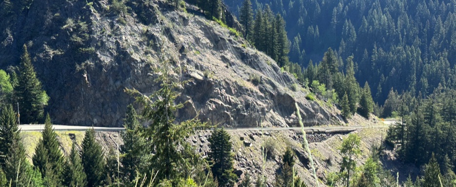
We resume cycling along the Crowsnest Highway (Highway 3), immersed in fairy-tale landscapes. The road is surprisingly quiet, framed by spruce and pine forests, with small alpine lakes reflecting the clear sky. Sunlight filters through the branches, accompanying a ride that alternates continuous climbs and descents, with slopes of 6–7%, keeping both focus and rhythm high.
We reach Manning Park Resort, a four-season oasis with a lodge, chalets, cabins, campground, restaurant, pub, and hiking trails. The place evokes memories of a previous bike tour, yet today the road calls us forward. As we continue, Highway 3 runs alongside the Similkameen River, flowing calmly, and we pause at a park sign depicting a stylized bear, likely one of the eastern entrances different from the one we encountered before.
The climb continues through grand panoramas to the Sunday Summit (~1,282 m), one of the last passes of this long mountain crossing. The subsequent descent opens onto a drier, brighter landscape: dense forests give way to wider valleys, farmland, rolling hills, and pastures, heralding entry into the Similkameen Valley.
Following Highway 3 eastward, we gradually leave the mountainous heart behind. Just before the town of Princeton, we turn onto Old Hedley Road West, a historic road running parallel to the river. We pass near Old Hedley Road West Campground, a simple recreational area immersed in nature along the Similkameen River, and shortly after reach the Riverhaven RV Park and Motel, about 3–4 km from Hedley.
This cozy private campground opens onto neat gravel pitches, the lawn sparse without irrigation, offering a relaxed atmosphere. The staff, likely the owners, welcome us warmly and tell us about local wildlife, including Western rattlesnakes that inhabit these warm, dry lands.
The campground also has a small market with essentials for travelers and, almost like an unexpected luxury, Wi-Fi. It is a brief moment of connection in the heart of the wild: we recharge both ourselves and our equipment, organizing photos and footage as the journey takes shape in memory.
After dinner, the sky over the Similkameen Valley darkens slowly, the air warm and still. In that silence, we notice the change: the mountains are now behind us, and ahead stretches the arid interior of British Columbia. The journey continues, but the transformation of the landscape and of our perspective has already begun.
Stage of the Route
• Tour map 📍: Map
• Distance 🚴: ~72.6 km
• Estimated duration ⏱: ~4h 55min, including stops
• Main locations: Manning Park → Manning Park Resort → Sunday Summit (1,282 m) → Similkameen Valley → Hedley → Princeton area
• Terrain: Mountain paved roads, continuous climbs and descents, long downhills, valley floors
• Elevation gain: ~690 m
• Elevation loss: ~1,280 m
• Direction: Generally southeast, along the Crowsnest Highway (Highway 3)
• Region / District: E.C. Manning Provincial Park → Similkameen Valley
• Difficulty: Medium – smoother than the previous day, but with short climbs and technical descents
• Points of interest: Manning Park Resort, Sunday Summit, Similkameen River, Hedley (historic mining town), semi-arid landscapes
• Overnight stay: Riverhaven RV Park & Motel (Hedley)
• Travel footage: Route stage and travel footage captured with Action Cam Insta360 X